

VORTRAG: Sanne Maekelberg
Mapping through space and time. The itinerary of Charles of Croÿ (1560-1612)
23.01.2018 um 19:00 Uhr
Sanne Maekelberg, University of Leuven (KU Leuven)
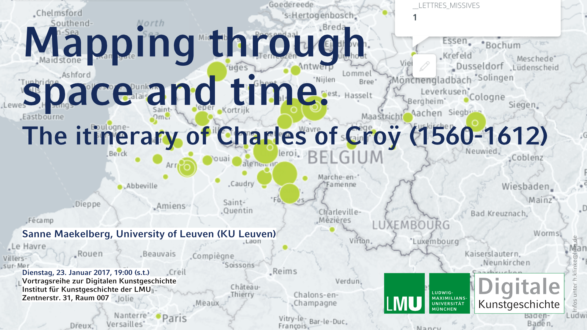
This paper explores the potential of GIS in visualizing the itinerary of Charles of Croÿ (1560-1612). At the end of the sixteenth century the noble lifestyle was still essentially nomadic, dictated by political necessity (like war) and pleasure (the hunt). Based on sixteenth-century sources a rough reconstruction of the whereabouts of this high nobleman during the main part of his career is possible. The aim of the present study is to test the use of GIS in itinerary visualizations where not only space, but also time plays an essential role. Through the narrative of one lifetime, spatial and temporal patterns are unravelled by querying the available data. Due to the non-systematic characteristic of historic data, the visualization also needs to deal with a lack of sources. There are huge gaps of time where no data on the whereabouts is available. How do we deal with these inconsistencies and more importantly: how do make them obvious to the viewer of the visualizations? Through the composed itinerary a correlation is sought with the network of residences, serving Charles of Croÿ and his nomadic lifestyle. According to Paravicini & Kruse, length and frequency of stay are paramount in defining which residence is “important” and which is not, an analysis that we want to apply to Charles of Croÿ. The perennial question is which residence is more important in the residential system and why.
Vortragsreihe zur Digitalen Kunstgeschichte
Institut für Kunstgeschichte der LMU
Zentnerstr. 31